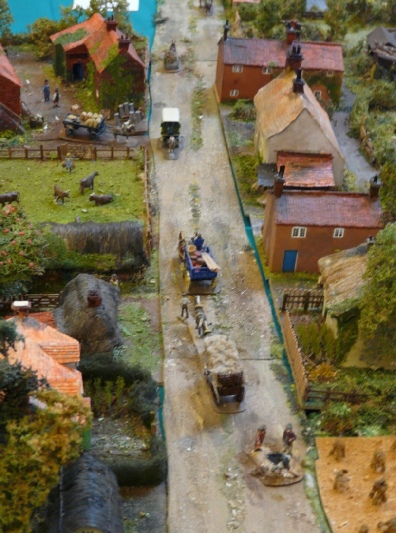
The Society is lucky to have a copy of the Sale Document of 1839 when the then Lord of the Manor sold off his estate and, whilst he did not own every building in the village, he did own a large proportion. The description of each property is such that our ever-resourceful Tony Stevens has created a model of how the village might have looked at that time. The above image is a small section of the entire village that Tony has created. Most noticeable is, that in 1839, there were still many thatched cottages still standing, many, however, described as almost hovels and not long to survive before being knocked down and replaced.
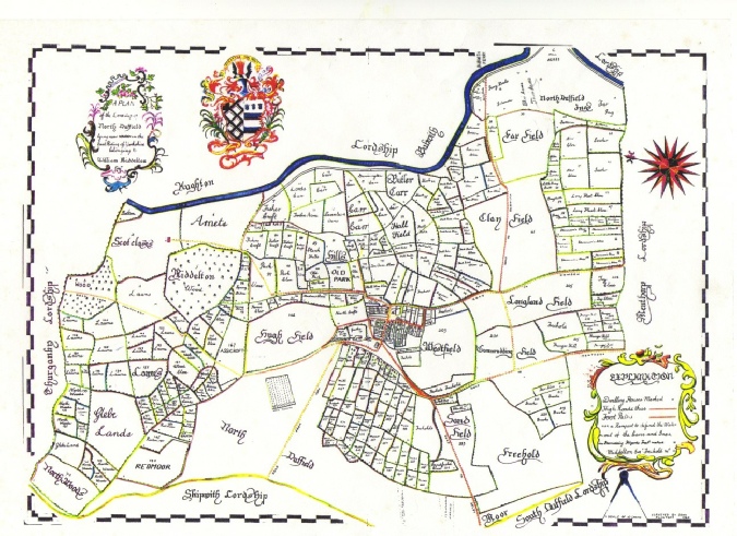
Finally, although the village green has been part of village life for hundreds of years, the pond, or The Pit as it is referred to on some maps, does not seem to have been so long-lived. No evidence of it can be found on the earliest map of which we are aware: John Flintoft’s map of 1760, created on behalf of the Lord of the Manor, shows a much larger village green but no pond. Now either that was a mistake or the pond did not then exist. If this map can be relied on, then the pond was created sometime after 1760 and before 1810, our next earliest map.
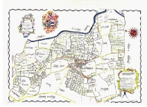
This map predates the first Ordinance Survey maps by almost 90 years so the cartographer, John Flintoft, must have been well-practised in his art. Significantly, the protocol of always drawing maps on a north-south axis had yet to be formulated. It should be noted that the River Derwent at the top of the map appears to be flowing east-west rather than correctly north-south. See of you can orientate yourself so that you start to recognise features that still exist today: remember, the A163 was not to be built until 1793 but you can still pick out the ferry and the track marked in red leading to the village coming out on Menthorpe Lane.
A small section of the model village
John Flintoft’s map of 1760
More photos of the model village can be seen here.