EXCAVATION
.
ARCHAEOLOGY NORTH DUFFIELD(AND) was formed in 2008 as a group within the structure of North Duffield Conservation and Local History Society (NDCHS). Until this time,the Society had not engaged in archaeology in any form
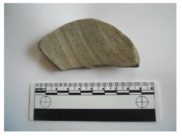
Our journey started when a piece of Roman pottery was found in a Society members garden in Broadmanor-
The only problem with archaeology is that, because the people leaving their traces in the landscape, pottery, structures etc for us to find, did NOT write down what they did or how they used them, then we have to try to understand for ourselves. Just look at the prolonged discussion about who built Stonehenge, how they built it and why they brought the stones from Wales.
Roman grey ware found in Broadmanor
A small group of interested members decided to form AND each making a donation, small sums of money to give us a ‘fighting fund’. We then successfully applied for a small grant from Communities in Partnership (later to become Community Engagement Forum) and this allowed us to purchase a set of tape measures.
Our plan was to investigate the historic environment of the village by means of landscape characterisation, archaeological fieldwork and studies of aerial photographs and crop mark transitions. It was of particular importance to us to involve local people, especially school children, in our work in investigating and caring for their local heritage and introducing more people to archaeology.
In those early days we had a group of people, many of whom had no previous archaeological experience, but, we also had others who had been volunteering for archaeological digs and local archaeological courses as well as people with a range of specialities that would be very valuable in our work.
We were lucky to have the professional support of Dr Jon Kenny, then employed by York Archaeological Trust as Community Archaeologist, as well as forging links with York University Department of Archaeology and the Council for British Archaeology also based in York.
Our first venture into the world of ‘real’ archaeology was to make use of the crop mark maps we had obtained. We started a programme of field-
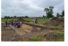
The final and, arguably, the most important element of the project was excavation. This would be the first excavation conducted by NDCHS under its section title of Archaeology North Duffield.
We already knew of the existence of a band of crop marks running from Blackwood crossroads, along the A163 and through the centre of the village and out to Parkhouse Farm before branching back off to the North West and on through Skipwith Common into Riccall. I am unable to show an image of these crop marks as Historic England, who own the copy write, have shown a reluctance to answer my requests to use them in publications.
On closer inspection of these crop marks, I decided to concentrate on what I believed to be a relatively simple area just south of Parkhouse Farm as our first venture into true archaeology.
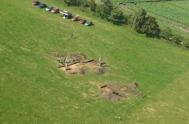
Aerial photograph of the dig in 2012 by Geof Eastwood
There followed a number of planning, meetings where we decided to apply for a Heritage Lottery Fund grant. A pre-
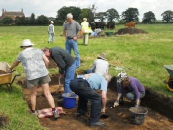
Our first job was to do a geophysical survey, made famous by Time Team. We first did a magnetometry survey. This machine recognises and records minor variations in the magnetic field of landscape: any disturbance of the landscape such as digging a ditch, will disturb the magnetic field and show up. We then commenced a resistivity survey which normally would record variations in the conductivity of the soil and, once again, record variations in conductivity caused by the presence of features. Unfortunately, the machine broke and we had to rely on triangulation to pinpoint the features we wished to excavate.
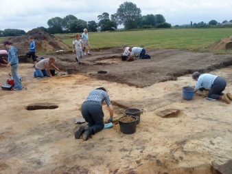
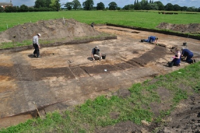
picture shows the ring ditch trench under excavation and the linear ditch in the back ground.
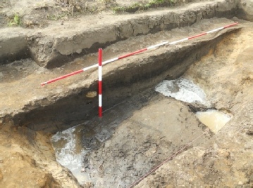
Linear ditch after excavation in 2012
The field in question had an east-
Over the week of the excavation in July 2012 we found pottery in the linear ditch later dated to the Iron Age and iron slag which is evidence of iron working. Unfortunately, following the wet spring, the ditch filled with water before we could fully excavate it but, we had managed to get dating evidence and prove the existence of the ditch.
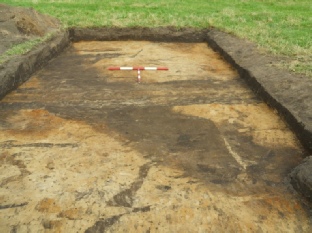
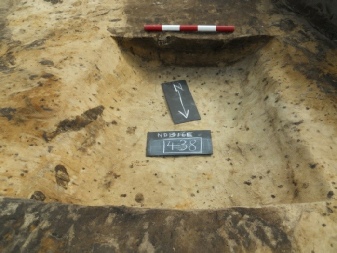
This picture shows the ring ditch running from top left to bottom right and field drain running across the centre of the picture. Taken before excavation, yellow sand was laid down 5-
The trial trench through the ring ditch was equally successful and further quantities of Iron Age pottery and iron slag were recovered. The third trench was more of an enigma. We never did find a feature in the trench even though we recovered Iron Age pottery from it but, it still was a useful exercise as we used it for training novice diggers.
At the end of the week, we back-
We returned to the site in 2013 for a further week of excavation, entering the dig in the Festival of Archaeology run by the Council for British Archaeology. We had estimated that, from the small area of the ring ditch that we had uncovered, the full ditch was about 16 meters in diameter. We were concentrating on the roundhouse ring ditch and open up a large trench on the western side of the feature only to find that it was much bigger than we had realised, 20 meters diameter, in fact. Once again we started to recover quantities of Iron Age pottery and iron slag. More importantly, this time we found the post holes that supported the roof and three features we believe were ‘hearths’ where the fire would have been situated. We found a number of other features mainly field drains of relatively modern date, ‘tree-
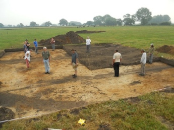
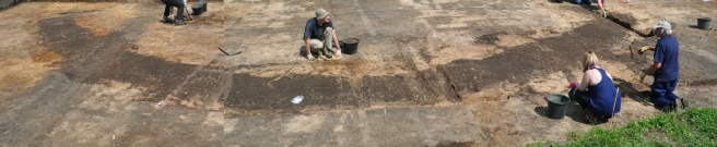
This picture shows the 2013 trench after opening. The ring ditch is visible in the bottom left and top left corners of the trench. Each person is standing on a post hole and one person standing where we believe the centre to be.
This excavation was interesting for other reasons as well. Apart from having our usual large number of willing volunteers to help we had a party of Young Archaeologists lead by the Council for British Archaeology and a young lad with terminal cancer from Bradford who had ‘attending an archaeological dig’ on his bucket list. In order for him to come, we extended the dig from a week to almost fortnight.
A slot through the ring ditch Post holes under excavation
The picture on the left shows a section through the ring ditch-
Once again, at the end of the dig we back-
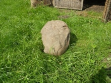
Anvil stone
Once all the analyses had been completed by the experts, we were able to say that the site had been in use from about 300BC and probably for no longer than 100 years when it had likely burnt down. The flint tools were either ‘residual’ meaning they had remained in the soil or had been curated as precious possessions of the ancestors indicating that the land was in use in 3000BC or 5000 years ago. We found another doorway facing west, unusual but not unique, with later Roman pottery in the post hole. It was suggested that the second doorway had been cut into the extant ring ditch and perhaps used as an animal compound in later Roman times 400AD
The ring ditch showing clearly and about to be excavated
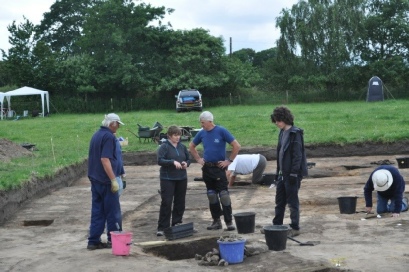
Dr Mel Giles on site explaining a feature
The southern section of ring ditch with the door terminal and doorway to the right-
Once again, the Young Archaeologists visited the site for the day with their parents. We had our usual group of volunteer diggers including archaeology students and ex professional archaeologists, children and residents as well as members of surrounding groups and villages. All in all a highly successful and rewarding experience for everyone. Crucially, we
proved that a little archaeology group run by the community could achieve great things and significantly add to the knowledge of what the landscape might have looked like in the Iron Age.
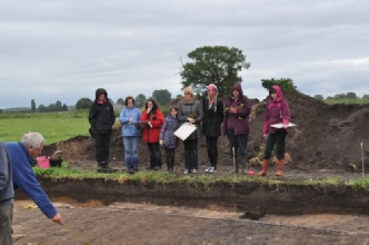
Jon Kenny explaining site planning to the Young Archaeologists and their parents.
A full version of this item can be found in the book : ‘North Duffield:Archaeology and the Local Community’ for sale from this website at £12.50(£15 with P & P)